
Few people really know the history of Komani Lake. Here’s a fact that most people on the boat don’t know: Komani Lake Albania doesn’t actually exist.
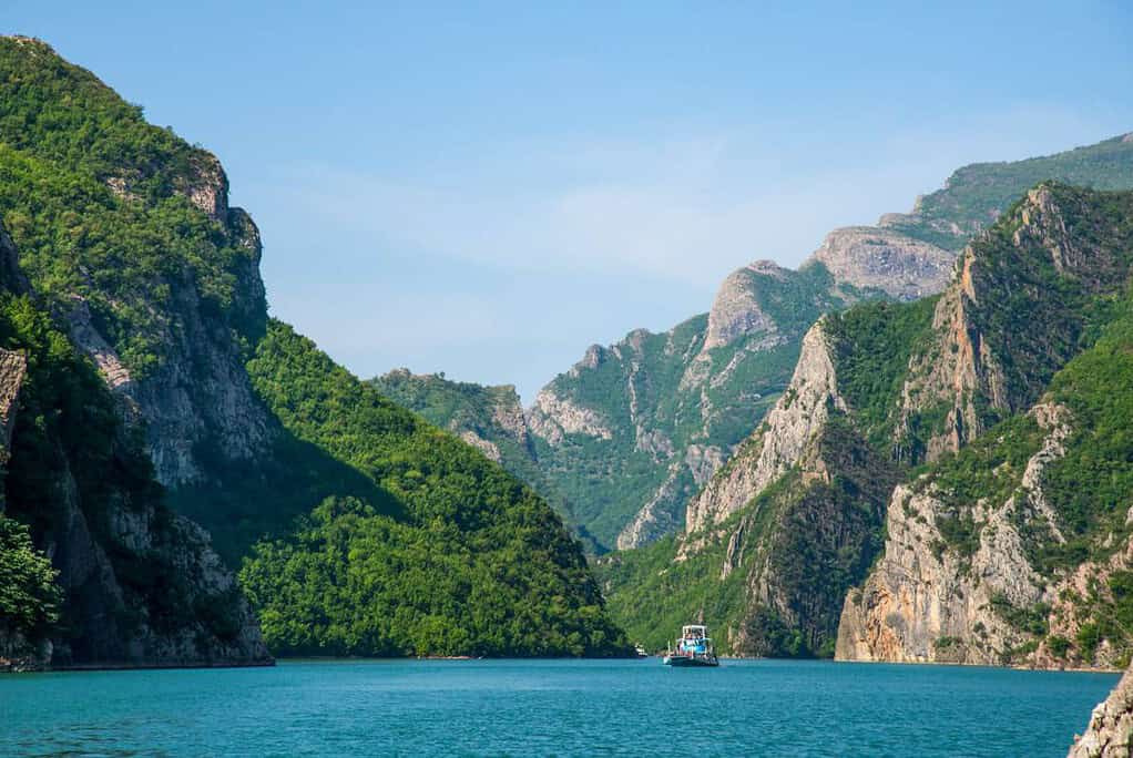
What you’re floating on is a reservoir. An artificial body of water created in the 1980s when Albania’s communist government needed electricity and had a river canyon to work with. The landscape, those towering limestone walls, that specific shade of turquoise, the villages hanging off the cliffs with no road in sight, looks like it has been there forever. Geologically, the canyon has. The lake itself is barely 40 years old.
That’s the thing that makes the history of Komani lake genuinely fascinating: nobody set out to create one of Europe’s most dramatic landscapes. It just happened. A government built a dam, the valley filled up with water, and what they left behind was accidentally, completely extraordinary.
Here’s the full story.
Before the Lake: The Drin River Albania and the Canyon It Carved
Long before there was a lake, there was the Drin River Albania.
The Drin is Albania’s longest river, around 280 kilometres from its mountain source to the Adriatic coast. It starts near the city of Kukes in the northeast, where two branches come together: the White Drin flowing down from Kosovo, and the Black Drin from Lake Ohrid in North Macedonia. From there, the river heads northwest, cutting through the Albanian Alps in a series of gorges that took millions of years to form.
The canyon that would eventually become Komani Lake Albania was the Drin River’s work slow, relentless erosion through limestone, until the walls rose up to 400 metres on either side and the river ran cold and clear along the bottom. It wasn’t scenic. It was just geography. A narrow gorge through difficult terrain, with a road along the bank connecting remote mountain villages to the outside world.
Inhabitation Around Komani
People lived here for thousands of years. The area around present-day Koman was the site of the Koman culture, an archaeological culture from the 6th to 9th centuries AD that plays an important role in understanding the origins of Albanian identity. The name Koman itself is believed to derive from the Cumans, a nomadic Turkic people. Artefacts from this period have been found throughout the region, and the fort on Dalmace Hill, now sitting above the lake’s waterline, is still considered a significant archaeological site.
For centuries after that, the canyon was simply a place people moved through and lived in. Farms on the terraces. A road along the riverbank. Communities connected to Shkoder and the lowlands by that road, and nothing else.
The Dam: How Komani Lake Albania Was Born
Albania Needed Power — and the Drin Had Plenty
To understand the history of Komani Lake dam, you need to understand Albania in the mid-twentieth century. Under Enver Hoxha, the country pursued one of the most extreme versions of communist self-sufficiency in the world. Cut off from Western markets, estranged from the Soviet Union, and eventually isolated from China too, Albania had to generate its own everything — including electricity.
The Drin River Albania was the obvious answer. It had a steep gradient, a reliable flow from mountain snowmelt, and crucially a canyon geography that made dam construction practical. The government planned a cascade of three dams along the river, each one feeding power into the national grid.
Three Dams, One River
The first dam went up at Vau i Dejes, downstream, completed in 1973. It worked providing more than half of Albania’s electricity almost immediately. Encouraged, the government moved to the second site: the narrowest point of the Drin canyon, near the settlement of Koman.
This is where the history of Komani Lake dam gets interesting. Construction began in 1979. The project was officially named “Drita e Partise” (“The Light of the Party”) in the style of the era. Engineers had to excavate tunnels through solid limestone canyon walls, install four French-manufactured turbines in an underground power hall, and build a rock-fill dam 130 metres high and 275 metres long. For context, that makes it one of the ten tallest dams of its type in Europe.
The Koman dam was completed in 1985. By 1986, the reservoir behind it had reached full capacity. With 600 megawatts of installed generating capacity across its four turbines, the Koman Hydroelectric Power Station became the most powerful of the three dams on the Drin cascade and the unlikely creator of what we now call Komani Lake Albania.
The third dam, at Fierza upstream, had actually been finished slightly earlier in 1978. It created Lake Fierza, still the largest artificial lake in Albania and now sits at the far end of the Komani lake boat tour route.
The Road Under the Water
When the reservoir filled, the old road along the Drin riverbank disappeared. The farmland on the valley floor went under. Families in the lowest-lying settlements were relocated. The canyon that had been a lived-in, travelled route through the mountains became an inland waterway practically overnight.
The road is still there, just 96 metres below the surface. In years of severe drought, when water levels drop significantly, parts of it and the ruins of old structures occasionally become visible again. Most of the time, boats on the Komani lake boat tour pass directly above it without anyone knowing.
From Isolated Reservoir to Albania’s Most Famous Boat Journey
For the first decade or so of its existence, Komani lake’s history was pretty quiet by tourist standards. Albania under Hoxha was one of the most closed countries in the world. Even after the democratic transition in the early 1990s, northern Albania stayed off the tourist map for years roads were rough, infrastructure was minimal, and very few people outside the country knew the lake existed.
What changed was gradual, and mostly word of mouth.
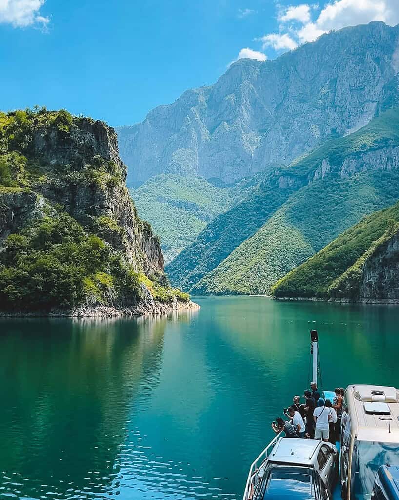
The road from Shkoder to Koman improved. Backpackers started making it to Albania through the 2000s and early 2010s, drawn partly by the Valbona Valley and Theth hiking routes. Some of them took the ferry. They told other people. Travel forums and early blogs picked it up as “Europe’s most beautiful boat journey,” “Albania’s best-kept secret,” “like Norwegian fjords but completely empty.”
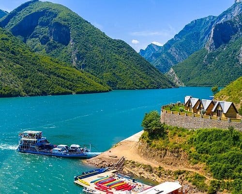
By the mid-2010s, the Komani lake boat tour had become a real thing. Operators started running organised day trips from Tirana and Shkoder. Such as the North Albania Boat. The family-run restaurants at Shala River started serving people from countries that, a generation earlier, wouldn’t have considered Albania a destination at all.
Today, the komani lake boat tour is one of the most in-demand day trips in the Balkans. The lake shows up in travel magazines, tourism campaigns, and about a million Instagram posts a year. The Norwegian fjord comparison, once a surprising observation from early visitors, is now standard marketing language, which is either a compliment or a sign of how quickly things move.
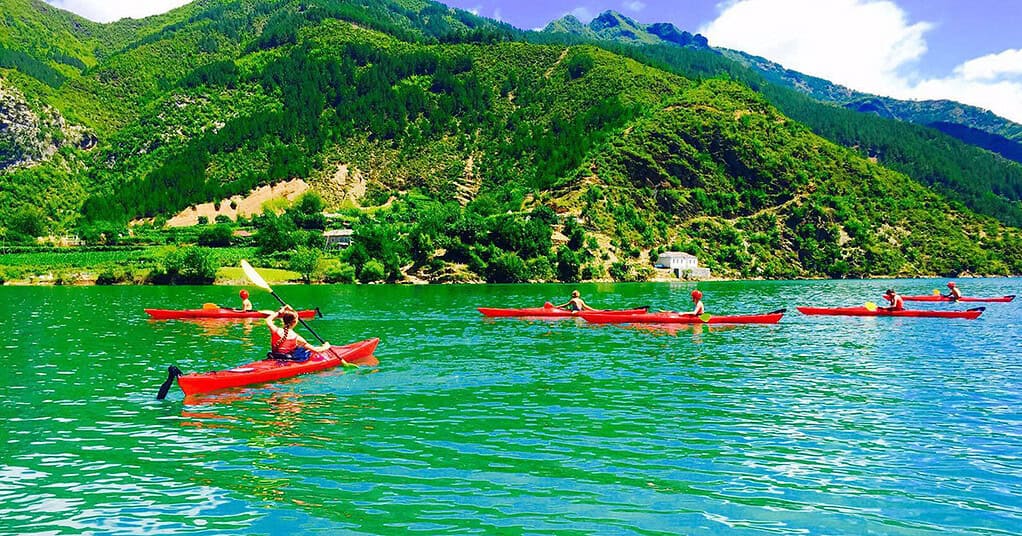
The Shala River Connection
One more piece of this story worth knowing: Shala River wasn’t always a destination either.
The river feeds into Komani Lake from the north, about two-thirds of the way along the crossing. It’s a natural canyon completely unaffected by the dam, running through limestone gorges that predate the lake by millions of years. The turquoise colour, the clarity, the cold: all of it comes from the same limestone geology and mineral-filtered water that characterises the wider Drin River Albania system.
There are still many things visitors don’t know about Shala River. It became a place people visited only because the lake gave them a way to reach it. The dam that flooded the Drin valley, the project that displaced families and submerged a road, also created the water highway that now carries tourists to one of the most beautiful spots in Albania.
Nobody planned any of this. The engineers who built the Koman dam were solving an electricity problem, not designing a travel destination. The canyon they flooded was a route through the mountains, not a scenic attraction. The villages they isolated by water were communities that had to adapt, not features of a boat tour.
And yet. The history of Komani Lake is a story about how extraordinary things sometimes happen sideways, as a side effect of something else entirely. A government built a dam. A valley filled with water. The canyon walls, the turquoise colour, the silence, the villages on the cliffs, all of it was already there. The lake just made it visible.
That’s what you’re floating on when you cross it.


")